How to Get to the Grand Canyon from Las Vegas, Flagstaff and Phoenix
The first question is not how to get to the Grand Canyon but which part of it you are going to. There are three answers, and they are hundreds of miles apart by road.
- The South Rim is the heart of Grand Canyon National Park. It is open all year, has two of the park’s entrances and gets about 90% of its visitors. By the National Park Service’s distance table it is 81 miles from Flagstaff, 231 miles from Phoenix and 278 miles from Las Vegas.
- The North Rim is the same national park on the other side of the river. It gets about 10% of visitors, opens only from May 15 through October 15, and is about 212 miles by road from the South Rim, even though the canyon averages only 10 miles across.
- Grand Canyon West, with the Skywalk, is on Hualapai tribal land at the far western end of the canyon, outside the national park. It is the closest part of the canyon to Las Vegas: 122 miles from the center of the city, about 2 hours and 15 minutes by road. From the South Rim it is about 250 miles, a five-hour drive.
Most people coming from Flagstaff, Williams, Sedona or Phoenix go to the South Rim. From Las Vegas you have a real choice between the South Rim and the West Rim, and a lot of day tours are sold without making that choice obvious. This guide takes each starting point in turn, then covers what happens once you reach the park.
Driving distances at a glance
These are the National Park Service’s approximate driving distances to the South Rim, plus its figures for Grand Canyon West. They are the numbers to use when choosing a base.
| From | To the South Rim | Main route |
|---|---|---|
| Williams, AZ | 63 miles (101 km) | Highway 64 north |
| Flagstaff, AZ | 81 miles (130 km) | I-40 and Highway 64, or Highway 180 |
| Sedona, AZ | 119 miles (192 km) | Highway 89A to Flagstaff, then via Williams |
| Phoenix, AZ | 231 miles (372 km) | I-17, I-40, Highway 64 |
| Las Vegas, NV | 278 miles (447 km) | Highway 93, I-40, Highway 64 |
| Albuquerque, NM | 412 miles (663 km) | I-40, Highway 64 |
| Los Angeles, CA | 494 miles (795 km) | I-15, I-40, Highway 64 |
| From | To Grand Canyon West | Time by road |
|---|---|---|
| Las Vegas, NV | 122 miles (196 km) | about 2 hours and 15 minutes |
| Kingman, AZ | 79 miles (127 km) | about 1.5 hours |
| The South Rim | about 250 miles (400 km) | about five hours |
A small inconsistency worth knowing: elsewhere on the same park page, the South Rim is described as 60 miles north of Williams and 80 miles northwest of Flagstaff. The difference is where you measure to. Either way, Williams and Flagstaff are the two towns on Interstate 40 that put you within roughly an hour or an hour and a half of the rim.
From Las Vegas: South Rim or West Rim
Las Vegas is the biggest starting point for Grand Canyon trips, and the one where the choice of rim matters most.
To the South Rim (278 miles). The park’s route is Highway 93 south to Kingman, I-40 east to Williams, then Highway 64 north to the South Entrance. It is a long drive for a day: the railway at Williams describes the town itself as about 3 hours from Las Vegas, and you still have the hour north to the rim. If you are driving, plan on at least one night near the canyon, in the park, in Tusayan or in Williams.
To Grand Canyon West (122 miles). Follow US-93 south toward Boulder City and on into Arizona, turn onto Pierce Ferry Road, then Diamond Bar Road, which runs into Buck and Doe Road and on to Grand Canyon West. The park service notes that the entire road is now paved. This is the realistic out-and-back day trip by car from Las Vegas.
What you give up at the West Rim is the national park itself. The Skywalk and the viewpoints at Grand Canyon West are run by the Hualapai Tribe, which charges its own fees to enter the reservation; your national park pass does not apply, and the park’s own shuttle buses, visitor centers and trails are all on the South Rim, about 250 miles away.
Tours from Las Vegas. You will see three broad kinds:
- Bus day trips to the South Rim. These cover the 278 miles each way in one day, so most of the day is on the road. Check how many hours the listing gives you at the rim and whether park entry is included.
- West Rim day trips, usually with a Skywalk option. Shorter on the road, but outside the national park.
- Helicopter and plane trips. Some fly from Las Vegas; some combine a flight with a ground tour. Our helicopter tours guide sorts them out.
One cost to check on any tour that goes into the national park: non-US residents aged 16 and over pay a $100 nonresident fee at Grand Canyon National Park on top of the standard entrance fee, and the park says this applies to people on commercial and concessioner tours too. Read whether a tour’s price includes it. The fee does not apply at Grand Canyon West, which is not in the park.
Flying. Grand Canyon Airport, in Tusayan just south of the park boundary, has limited air service from the Las Vegas area. (The park’s own pages put it 7 miles or 10 miles south of the park, depending on the page.) Commercial airlines also serve Phoenix, Flagstaff and Las Vegas, which is how most visitors arrive in the region.
From Flagstaff: three roads to the rim
Flagstaff is the most convenient base on the Arizona side, with an airport, Amtrak trains and a choice of three roads. The park puts it 81 miles from the South Rim and about 90 minutes from the South Entrance.
- I-40 west to Williams, then Highway 64 north. Interstate most of the way, to the South Entrance and Grand Canyon Village.
- Highway 180 west to Valle, then Highway 64 north. A shorter line on the map that joins the same approach to the South Entrance.
- Highway 89 north to Cameron, then Highway 64 west to the East Entrance at Desert View. The East Entrance is 25 miles west of Cameron, a town on the Navajo Nation. Desert View is 23 miles from Grand Canyon Village, so this route lets you drive the whole of Desert View Drive along the rim.
A good loop for a first visit is to go in one way and out the other: up through Williams or Valle to the South Entrance, along the rim to Desert View, and back to Flagstaff by Cameron. The park pass you buy at the first entrance is valid for seven days, so you are not charged again at the second.
From Sedona, 119 miles from the South Rim, the park’s route is Highway 89A up to Flagstaff and then on through Williams.
Without a car from Flagstaff or Sedona, small-group tours do the driving. The one on our tours page picks up at hotels in both towns, takes the eastern road past Wupatki and Sunset Crater Volcano national monuments and the Cameron Trading Post on the Navajo Nation, and then visits viewpoints on the East and South Rims. By its listing it lasts about 9 hours from Flagstaff and 11 from Sedona, and lunch is on your own. Non-US residents pay the $100 nonresident park fee on top; the listing says to arrange it with the tour company before the day.
From Williams: the Grand Canyon Railway
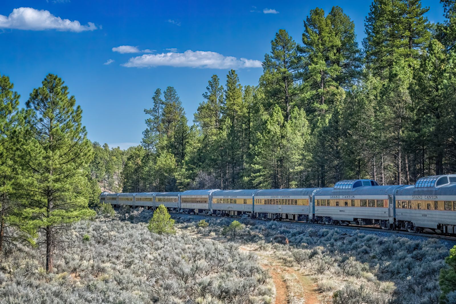
Williams is the Interstate 40 town due south of the South Rim, 63 miles away on Highway 64. The National Park Service puts the drive at about 60 minutes. The town also has the one option that avoids the road entirely: the Grand Canyon Railway, which has carried passengers to the canyon since 1901.
The timetable, from the railway’s own site:
| January 1 to October 31 | November 1 to December 31 | |
|---|---|---|
| Leaves Williams | 9:30 a.m. | 8:30 a.m. |
| Arrives at Grand Canyon Depot | 11:45 a.m. | 10:45 a.m. |
| Leaves Grand Canyon Depot | 3:30 p.m. | 2:30 p.m. |
| Back in Williams | 5:45 p.m. | 4:45 p.m. |
The trip is 65 miles by rail and takes 2 hours and 15 minutes each way, which leaves you a little over 3 hours at the South Rim. There is no train on December 25, and at times of high demand a second train leaves Williams at 10:30 a.m. The railway warns that its steam-hauled departures can be cancelled at any time, including on the day. The train stops in the Historic Village at the South Rim, so you step off within walking distance of the rim and the Village shuttle route. The railway sells six classes of service, and a Wild West shootout is staged in Williams before the train leaves.
The railway suits three kinds of visitor: those who do not want to drive the last hour and park at a busy rim, families who want the journey to be part of the day, and anyone staying in Williams who wants a fixed plan. It suits less well if you want sunset at the rim, since the train leaves the canyon in mid-afternoon. Williams is about 30 minutes west of Flagstaff on I-40, with Route 66 running through downtown, and the railway’s hotel and RV park are next to the depot. The depot itself dates from 1908 and now holds the ticket counter.
From Phoenix
Phoenix is the large city with a major airport to the south. The park’s route is I-17 north to Flagstaff, I-40 west to Williams and Highway 64 north to the South Rim: 231 miles in all, which the park describes as approximately a four-hour drive. That makes a same-day round trip possible but long, with roughly eight hours in the car.
The usual ways to cut it down:
- Stay a night near the rim, in Tusayan or Williams, or in Flagstaff.
- Break the drive in Sedona, which is on the way if you take Highway 89A up to Flagstaff.
- Take a tour from Phoenix, which handles the driving and the parking. As with tours from Las Vegas, check how long you get at the rim and whether the park entrance fee, and for non-US visitors the $100 nonresident fee, is included.
Without a car
You can reach the South Rim without driving, though it takes more planning than a car does.
- Amtrak to Flagstaff, which the park says has connecting bus service to the canyon.
- The Grand Canyon Railway from Williams, daily, as above.
- Flights to Grand Canyon Airport in Tusayan, with limited service from the Las Vegas area.
- Tours run by companies that hold a commercial use authorization from the National Park Service; the park keeps a searchable list of them.
- Taxis, which are allowed to operate in the park without that authorization.
Once you are at the South Rim, the free park shuttles cover the village and the main viewpoints, so a car is less necessary inside the park than it is getting there.
Arriving at the South Entrance
The South Entrance is 6 miles north of the town of Tusayan, which has the Grand Canyon Airport. Three things to know before you reach the booth:
- No reservation or timed entry is needed. You just buy or show your pass at the entrance station.
- Bring a card. The park does not accept cash. Standard passes cost $20 to $35 and are valid for seven days; our tickets and prices guide has the full list.
- Time your arrival. The park says visitor numbers peak at spring break in March and April, from Memorial Day to Labor Day, and in major holiday weeks, and that weekends are busier. At busy times it recommends reaching an entrance station before 10 a.m. or after 2 p.m. to cut the wait.
In summer you can also leave the car in Tusayan. The Tusayan (Purple) shuttle runs only in the summer months, every 45 minutes from 8 a.m. to 9 p.m., between Tusayan and the South Rim Visitor Center, 6.8 miles away. Like every park shuttle it needs no ticket; the park says a portion of your entrance fee pays for the service.
Getting around the South Rim
The park runs free shuttle buses on the South Rim, and the cost is covered by your entrance fee. The park describes the routes as interconnecting but not overlapping. In fall 2026 (September 12 through November 30) the routes were:
- Village (Blue) Route: a 50-minute loop linking the Visitor Center with the lodges, campgrounds and Market Plaza.
- Kaibab Rim (Orange) Route: 50 minutes round trip, east to the South Kaibab Trailhead and Yaki Point, and west to Mather Point and the Yavapai Geology Museum.
- Hermits Rest (Red) Route: 80 minutes round trip along the 7-mile Hermit Road, with stops at the overlooks.
- Hikers’ Express: early morning buses from Bright Angel Lodge to the South Kaibab Trailhead, at 6 a.m., 7 a.m. and 8 a.m. in fall 2026.
Hermit Road is closed to private vehicles from March 1 through November 30; in those months the shuttle and commercial tours are the only motorized way along it, though you can walk or cycle it. Desert View Drive, the 23 miles east to Desert View, is usually open to private cars all year unless snow closes it.
The North Rim in 2026
The North Rim is a different trip altogether. Its season runs from May 15 through October 15, and between December 1 and May 14 the North Rim and State Route 67 are closed to all vehicles. The entrance station is 30 miles south of Jacob Lake on State Route 67, and the rim and its services are another 14 miles beyond it. There is no airport or rail service, so the North Rim can only be reached by road.
From the South Rim it is about 212 miles by road, a drive the park puts at about 4 1/2 hours: out through the East Entrance to Cameron, north on Highway 89, west on Highway 89A to Jacob Lake and south on Highway 67. The only way to cross the Colorado River by car is far upstream, on Navajo Bridge at Marble Canyon, 137 miles from the South Rim village.
Two notes for 2026. The park said the season would focus mainly on day use, with limited services and no drinking water on the North Rim, so bring your own. And the flash flood of August 29, 2026 closed a large part of the inner canyon. The park’s hiking page lists as closed:
- the whole North Kaibab Trail, from the North Rim trailhead to Phantom Ranch;
- all of Phantom Ranch, including its campground, canteen and cabins;
- the Black Bridge and Silver Bridge over the Colorado River;
- the Bright Angel Trail below Mile-and-a-Half Resthouse, and the South Kaibab Trail below the Tip-Off.
That rules out rim-to-rim hiking (a 21-mile trip the park says is an overnight hike for 95% of people) and any walk down to the river from the South Rim until the park reopens these sections. The upper parts of the Bright Angel and South Kaibab trails remain open.
Altitude, heat and the season
- Altitude. The South Rim averages 7,000 feet above sea level. The park warns that walking at this elevation can be strenuous, especially for visitors with heart or breathing problems.
- Heat below the rim. The inner canyon is a harsh desert with little shade and summer temperatures over 100°F.
- Winter. The South Rim is open 24 hours a day, 365 days a year, and the least crowded months are November through February. Winter weather is the trade-off: during storms some roads may be closed for a while as snow is cleared, so check the park’s road conditions before you set out.
Day trip or overnight?
A day trip works from Williams and Flagstaff, and from Las Vegas to the West Rim. From Las Vegas to the South Rim, or from Phoenix, it works only if you accept a very long day or let a tour do the driving.
If you can stay a night, the payoff is the light: sunset and sunrise at the rim, when most day visitors have gone. The park strongly recommends reservations for lodging and camping in spring, summer and fall, so book that before anything else. For the paid options side by side, see the tours page.
Frequently asked questions
How far is the Grand Canyon from Las Vegas?
The South Rim is 278 miles from Las Vegas by the park’s route through Kingman and Williams. Grand Canyon West, with the Skywalk, is 122 miles from the center of Las Vegas, about 2 hours and 15 minutes by road, but it is on Hualapai land outside the national park.
How far is the Grand Canyon from Flagstaff?
81 miles to the South Rim by the park’s distance table, and about 90 minutes to the South Entrance. You can go via Williams, via Highway 180 and Valle, or via Cameron to the East Entrance at Desert View.
Can you take a train to the Grand Canyon?
Yes. The Grand Canyon Railway runs daily from Williams, leaving at 9:30 a.m. (8:30 a.m. in November and December) and stopping in the Historic Village at the South Rim, with a little over 3 hours at the canyon. Fares start at $69.98 for an adult in Pullman Class. Amtrak serves Flagstaff, with a connecting bus.
How long is the drive from Phoenix?
The park puts it at 231 miles and approximately four hours, by I-17 to Flagstaff, I-40 to Williams and Highway 64 north.
Is the West Rim part of Grand Canyon National Park?
No. Grand Canyon West and the Skywalk are on the Hualapai Reservation, outside the park. The Hualapai Tribe sets its own fees, and a national park pass does not cover them.
Can I drive to the North Rim from the South Rim in a day?
You can, but it is about 212 miles and 4 1/2 hours each way, and the North Rim is only open from May 15 through October 15.