Places
Things to Do at the Grand Canyon: South Rim Sights, Drives, Walks and Tours
Grand Canyon National Park has about six million visitors a year, and the park itself points out that most of them never hike into the canyon. They do not need to. The South Rim, where 90% of travelers go, has a paved Rim Trail, free shuttle buses, a geology museum perched on the edge, a historic village of early twentieth-century hotels and studios, and a scenic drive east to a stone watchtower. Beyond the rim there are mule rides, river trips, flights and, far to the west on Hualapai land, the glass Skywalk.
This list covers the best things to do at the Grand Canyon, roughly in the order a first-time visitor meets them on the South Rim, with the practical details from the National Park Service: what is free, how to get there, and what was open in October 2026.
Start at Mather Point and the visitor center
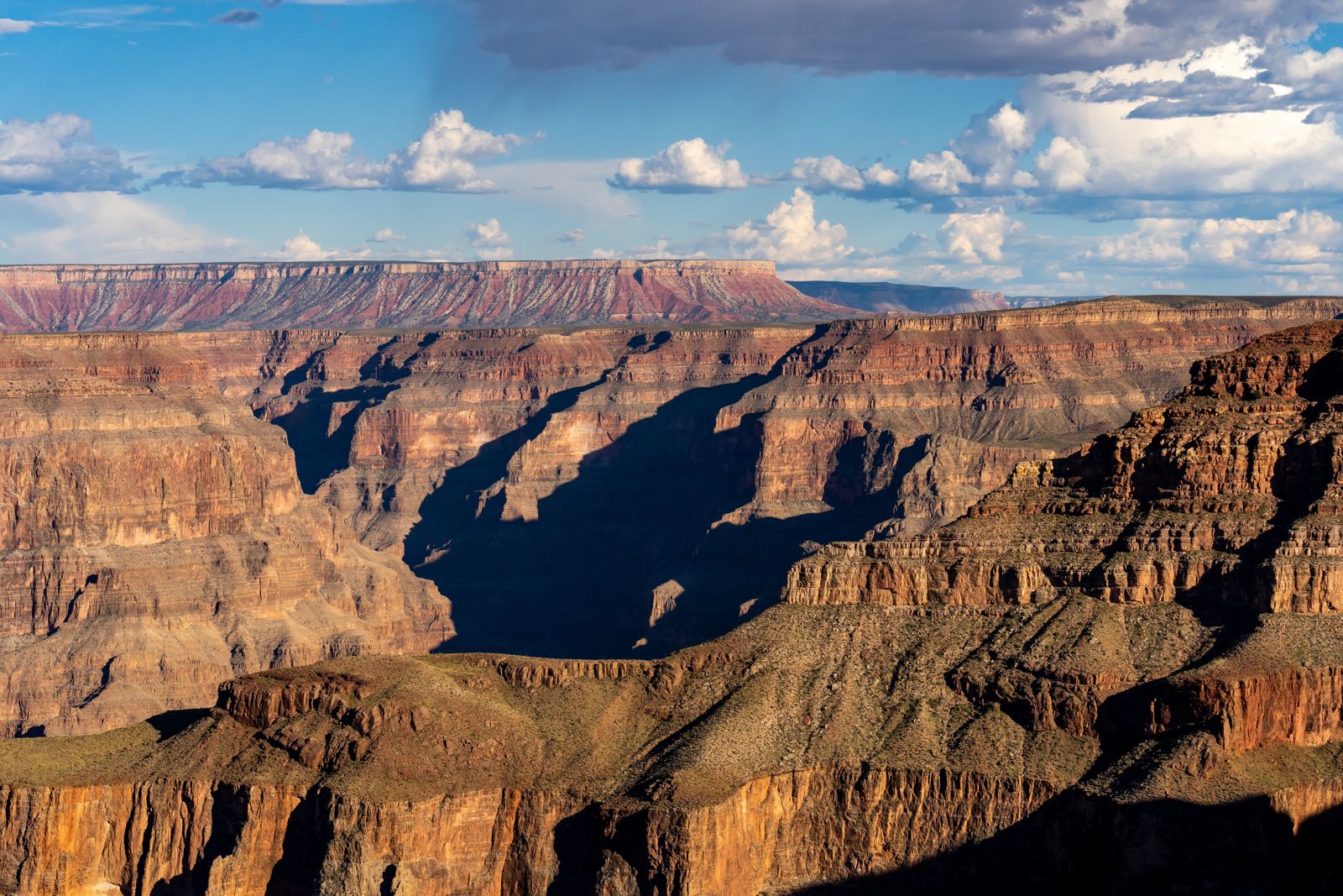
For many first-time visitors the first big view is Mather Point, close to the main visitor center and its shuttle terminal. From here you can see why the park describes the canyon as a mile deep yet only 10 miles across on average.
Use the visitor center as a base. The free shuttles start here, and all shuttle service is included in your entrance fee:
- Kaibab Rim (Orange) Route: east to the South Kaibab Trailhead, Yaki Point and Pipe Creek Overlook, and west to Mather Point and Yavapai Geology Museum. It runs year-round.
- Village (Blue) Route: a loop to the lodges, restaurants, campgrounds, the Backcountry Information Center and Market Plaza. It also runs year-round.
- Hermits Rest (Red) Route: out along Hermit Road, from March 1 through November 30.
The paved Rim Trail links the main viewpoints, so the simplest plan is to walk a section of rim and ride the bus back. From Pipe Creek Vista, for example, it is 1.3 miles (2.1 km) west to Mather Point or 0.8 mile (1.3 km) east to the South Kaibab Trailhead. Every visit needs an entrance pass; our guide to Grand Canyon tickets and prices covers the fees.
Yavapai Geology Museum
Half an hour’s walk west of Mather Point, Yavapai Geology Museum sits right on the edge of the rim at Yavapai Point. The park calls it one of the best vantage points for an overview of Grand Canyon geology, and the big picture windows are labeled so you know where to look for each group of rocks.
Inside:
- A large tactile relief model of the canyon in the front room, which mimics the view outside in remarkable detail.
- Geology talks by park rangers.
The building has its own history. Architect Herbert C. Maier designed it in local Kaibab limestone and ponderosa pine, and it was first dedicated in July 1928 on a site chosen by geologists to observe the canyon. The park re-dedicated it on May 24, 2007, with the current exhibits. It is open 8 am-6 pm daily, and in winter the park recommends it as a warm place with a window wide enough to take in the canyon.
Walk the Trail of Time
From the museum, the Trail of Time follows the Rim Trail west toward Grand Canyon Village. It is a relatively flat, paved geologic timeline, 4.56 km (2.83 miles) long in all, on which each meter walked stands for one million years of the canyon’s history. Bronze markers show where you are in time, and real rocks from each layer sit beside the path at their age.
The section from Yavapai Geology Museum to the village is 1.3 miles (2.1 km), a fully accessible walk of about an hour, and it takes you backward in time from today toward the canyon’s oldest rocks. The numbers are staggering: the park’s ranger video puts the oldest rock at the bottom of the canyon at about 1.8 billion years old and the youngest, at the rim, at about 270 million years. The canyon itself is young, carved into these old rocks over only the last five or six million years. The trail was dedicated on October 13, 2010.
Explore the historic village
Grand Canyon Village grew up around the railroad. On September 17, 1901, the first steam train on the Santa Fe Railway’s spur line reached the South Rim, and within a decade the luxurious El Tovar hotel and shops such as Hopi House and Verkamp’s Curios had been built. Much of that village survives, and the park has preserved it as a historic district you can wander freely.
Buildings worth finding:
- El Tovar: the most luxurious hotel west of the Mississippi River when it opened in 1905.
- Hopi House: a multi-story stone building shaped like a Hopi pueblo, directly across from El Tovar. Some of the Hopi who worked there once lived on its upper floors.
- Verkamp’s: a curio shop and family home for more than a century, now a visitor center.
- The railway depot: one of the oldest standing wooden train depots in the United States.
- Buckey O’Neill Cabin: considered the oldest continuously standing structure on the South Rim.
- Kolb Studio: the home and studio the Kolb brothers, known for their daring photographs, built on the rim edge in 1904. The Bright Angel Trail begins just west of it.
- Lookout Studio: a stone building of 1914, designed for visitors to photograph the canyon and look through telescopes from the very edge.
Trains still arrive. The Grand Canyon Railway runs daily trains from Williams, Arizona, and drops passengers in the historic village; our guide to getting to the Grand Canyon compares the train with the drive and the day tours.
Mary Colter’s buildings
Four of the most striking buildings on the South Rim are the work of one designer. Mary Elizabeth Jane Colter, born in Pittsburgh in 1869, was chief architect and decorator for the Fred Harvey Company from 1902 to 1948, and her Grand Canyon buildings took their forms from the landscape and from Native American architecture of the Southwest.
The park names Hopi House (1905), Hermit’s Rest (1914), Lookout Studio (1914) and the Desert View Watchtower (1932) as among the only remaining works of hers, and as a group they were designated a National Historic Landmark District on May 28, 1987. You can see three of them in a single walk and ride along the rim, and the fourth at the end of Desert View Drive.
Ride or bike Hermit Road to Hermits Rest
West of the village, Hermit Road runs 7 miles along the rim to Hermits Rest, with nine overlooks along the way. From March 1 through November 30 it is closed to private cars, and the free Red Route shuttle is the way in. In December, January and February you can drive it yourself, unless it is closed by snow.
How to do it:
- By shuttle: outbound buses stop at all nine overlooks; return buses stop only at Hermits Rest and the Pima, Mohave and Powell points. Staying on the bus, the round trip takes 80 minutes.
- On foot: the Rim Trail runs all the way to Hermits Rest, 7.1 miles (11.4 km) from the village. Mix walking and riding: get off at one stop, walk the rim, and board at the next.
- By bike: foot and bicycle traffic is allowed all year, and the park suggests riding out to Hermits Rest and returning by shuttle.
In busy seasons the line at the Hermit Road Transfer Station can mean waiting for two to three buses. The park’s tip: walk 0.7 mi (1.1 km) up the paved path to Trailview Overlook and board there.
At the end, Hermits Rest itself is a Colter building of 1914, built as a rest stop for the stage line from El Tovar and designed to look as if an untrained mountain man had piled it together from local boulders and timber. The rugged Hermit Trail begins nearby.
Drive Desert View Drive
East of the village, Desert View Drive is the only scenic drive on the South Rim open to private cars. It runs 23 miles (37 km) to Desert View and the East Entrance, with six developed viewpoints, four picnic areas and five unmarked pullouts, and parking at every viewpoint.
Highlights, west to east:
- Yaki Point: reachable only on foot, by bike or on the Orange Route shuttle, with wide views and the South Kaibab Trailhead nearby.
- Duck on a Rock: at 7,096 feet (2,162 m), named for a rock formation early visitors liked to spot.
- Grandview Point: at 7399 feet (2256 m), with panoramic views east and west and several bends of the Colorado River. The steep Grandview Trail starts here.
- Moran Point: at 7160 feet (2182 m), named after the painter Thomas Moran, where three main rock groups are clearly visible: the layered Paleozoic rocks, the Grand Canyon Supergroup and the basement rocks.
- Tusayan Pueblo: the remains of a small Ancestral Puebloan village 3 miles (5 km) west of Desert View, with a self-guiding trail. In 2026 it was open from April 2 through October 31, 8 am to 4 pm.
- Lipan Point: with views of Hance Rapid and the Unkar Delta, once home to Ancestral Puebloan people, but closed between June 22 and December 23, 2026, for rehabilitation work.
- Navajo Point: at 7461 feet (2275 m), the highest overlook on the South Rim, with a view of the Watchtower and a memorial to the airline collision over the canyon on June 30, 1956.
Climb the Desert View Watchtower
At the eastern end of the South Rim, at 7438 feet (2267 m), Desert View has some of the best views of the Colorado River as it makes a big bend to the west, and looking northeast you can see the river leave narrow Marble Canyon for the wider Grand Canyon. Rising above it is Mary Colter’s Desert View Watchtower, built in 1932.
The tower stands 70 feet tall on a 30-foot base. From a distance it looks like an Ancestral Puebloan watchtower; Colter patterned it after towers at Hovenweep and the Round Tower of Mesa Verde, but hid a concrete foundation and a steel frame, designed by the Santa Fe Railway’s bridge builders, inside the stone.
Inside:
- The View Room on the ground floor is modeled on a traditional kiva, and in 2015 it was returned to the open rest area Colter intended. Indigenous artists give cultural demonstrations here in spring, summer and fall, and reflectoscopes, viewers with black glass mirrors, cut the glare to show the canyon’s colors.
- The Hopi Room upstairs has paintings by Hopi artist Fred Kabotie on the theme of the Hopi Snake Dance.
Admission is free. Upper-floor access works by free tickets, first come, first served: 25 people at a time, for 20 minutes, with the last tickets handed out at 3:40 pm and last access at 4 pm. The two park pages give different closing hours for the upper floors, 4 pm on one and 5 pm on the other, so check on the day. A short 0.25 mile (0.4 km) walk from the main parking area brings you to the tower.
Park shuttles do not go to Desert View, so you need a car or a commercial bus tour. There is no overnight lodging there, and in 2026 the trading post, market and deli closed for the winter on October 19, though a 24-hour pay-at-the-pump gas station stays open.
Meet the canyon’s peoples
The canyon is a homeland as well as a park. The park describes Desert View as a gathering place for thousands of years and as the physical and cultural gateway from the park to the Navajo and Hopi lands, and Hopi House was built, in the park’s words, as a tribute to the Hopi and their ancestors, who have inhabited the Grand Canyon for centuries.
To learn more, visit Tusayan Pueblo in season, watch the cultural demonstrations in the Watchtower’s View Room, and, in the far west, visit Grand Canyon West, run by the Hualapai Tribe.
Walk a little way below the rim
Even a short walk down a trail changes how big the canyon feels. The Bright Angel Trail starts in the village and the South Kaibab Trail near Yaki Point; both are steep, and the park’s advice is to turn around early, because the climb back out takes about twice as long as the walk down.
After flash flooding on August 29, much of the inner canyon was closed. In October 2026 the Bright Angel Trail was open to Mile-and-a-Half Resthouse and the South Kaibab Trail to the Tip-Off. Our article on hiking the Grand Canyon covers the trails, distances and heat safety.
Take a mule ride
From the South Rim there is a two-day round-trip ride to the Colorado River, with the night at Phantom Ranch, booked well in advance. On the North Rim, one-hour rides along the rim and half-day trips are usually available daily in the season, between May 15 and October 15. Note that Phantom Ranch was closed in October 2026 after the flood, so check what is running before you plan around it.
See the canyon from the air
A flight shows the scale of the canyon in a way no single viewpoint can. Helicopter and airplane tours fly over the canyon from the South Rim area and from Las Vegas. Our guide to Grand Canyon helicopter tours compares the routes and what each includes.
Float or raft the Colorado River
The river that carved the canyon offers trips of every length:
- A half day or full day: smooth-water raft trips start in Page, Arizona, and run on the stretch of the Colorado between Glen Canyon Dam and Lees Ferry, motoring 10 miles upriver to Petroglyph Beach.
- A week or more: commercial whitewater trips from Lees Ferry last 3 to 18 days and are often reserved a year or two in advance. Motor trips usually take at least 7 days to reach Diamond Creek; half trips hike in or out at Phantom Ranch.
- Self-guided: private trips of 12 to 25 days are allocated by weighted lottery.
The park is clear that there are no one-day river trips through the length of the Grand Canyon.
Visit the West Rim and the Skywalk
The Skywalk is not in the national park. It stands at Grand Canyon West, on the reservation of the Hualapai, the People of the Tall Pines, who have lived in the Southwest for untold generations. The Skywalk is a horseshoe-shaped steel frame with glass floor and sides projecting about 70 feet (21 m) from the canyon rim, and it is managed by the tribe.
Location is the key fact. Grand Canyon West is about 250 miles (400 km) by road, a five-hour drive, from the South Rim, but only 122 miles (196 km), about 2 hours and 15 minutes, from the center of Las Vegas. That makes it an easy day trip from Las Vegas, and many tours combine it with the drive or a flight. The tribe collects its own fees to enter the reservation, separate from the national park’s.
The North Rim in season
The North Rim is higher, quieter and open only part of the year; in 2026 its season ran from May 15 through October 15. Its scenic roads lead to viewpoints such as Cape Royal, where an easy, flat, paved walk of 0.6 mile (1.0 km) round trip looks out over the canyon, Angels Window and the Colorado River.
The 2026 season was limited. After the Dragon Bravo Fire, the park focused on day use, closed rim trails including Bright Angel Point, Transept and Widforss, and warned that there was no potable water. Cape Royal Road and Point Imperial Road close from sunset October 15 through sunrise November 3, 2026, for repairs. Check the park’s North Rim status before planning a trip next year.
Planning your day on the South Rim
A day on the South Rim can cover a lot if you use the shuttles:
- Morning: Mather Point, then walk the Rim Trail to Yavapai Geology Museum and on along the Trail of Time to the village.
- Midday: lunch in the village, then El Tovar, Hopi House, Lookout Studio and Kolb Studio.
- Afternoon: the Red Route out along Hermit Road, walking a stretch of rim between stops, to Hermits Rest.
- A second day: Desert View Drive to the Watchtower, stopping at Grandview, Moran and Navajo points.
If you are coming on a day trip from Las Vegas or Flagstaff, you will have only a few hours on the rim, so pick the village and one viewpoint area. The weather matters too: our article on Grand Canyon weather explains what each season brings.
Frequently asked questions
What is the number one thing to do at the Grand Canyon?
For most visitors, walking the Rim Trail on the South Rim: from Mather Point past Yavapai Geology Museum and along the Trail of Time to the historic village. It is paved, mostly flat and served by free shuttles.
Is the Skywalk in Grand Canyon National Park?
No. The Skywalk is at Grand Canyon West on the Hualapai Reservation, about 250 miles by road from the South Rim and 122 miles from the center of Las Vegas. The Hualapai Tribe sets its own fees.
Is the Desert View Watchtower free?
Yes. Admission is free, and access to the upper floors is by free tickets, first come, first served, for 25 people at a time with a 20 minute limit.
Can you drive Hermit Road?
Only in December, January and February, unless it is closed by snow. From March 1 through November 30 it is closed to private cars, and the free Red Route shuttle runs instead.